
NASA Acres Helps Turn Earth Observation Science into Impact for Farmers, Local Communities, and Tomorrow's Agricultural Workforce
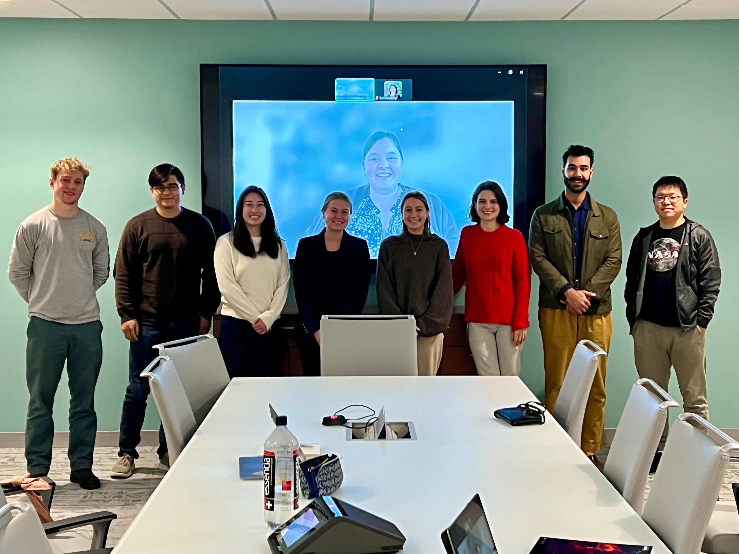
NASA Acres’ Jacob Orser and Drs. Michael Humber and Allison Bredder, DEVELOP participants Madeline Kronebusch, Carlie Wetherbee, and Cecelia Paparella, NASA Harvest’s Kara Mobley, DEVELOP participant Yazan Hasan, and UMD Associate Research Professor Tony Chen collaborating at UMD during the temporary government shutdown.
From California vineyards to farms in Texas and Maryland, NASA satellite data is informing critical agricultural decisions while helping prepare the next generation of applied Earth science professionals. Through sustained investment in workforce development and Earth observation research, NASA, in collaboration with NASA Acres, is translating space-based science into practical tools that strengthen farms, rural economies, and state and local planning.
One impactful example of this commitment has been NASA’s DEVELOP Program, which for more than two decades engaged early career researchers in applied science projects using NASA Earth observations to address real decision-making needs. Participants worked directly with local, state, and federal partners to turn satellite data into usable products, gaining hands-on experience in data analysis, stakeholder engagement, and science communication. Over the years, the program built a strong workforce development model that advanced technical expertise while delivering tangible value to communities.
In 2025, NASA Acres supported DEVELOP teams focused on agriculture, resilience, and land-use change. Among these efforts, a NASA-Acres-supported project helped the Maryland Department of Agriculture assess how solar development is reshaping prime farmland on the Eastern Shore. The project advisors included NASA Acres’ Drs. Mike Humber and Allison Bredder, along with Jacob Orser, working together with the Goddard Space Flight Center. When the federal government experienced a temporary shutdown, NASA Acres also hosted the DEVELOP researchers at the University of Maryland so their work could continue uninterrupted.
Using Landsat, Sentinel-2, and other satellite datasets, the team mapped more than a decade of land-use change, identified acreage converted from agriculture to solar, and evaluated potential economic impacts on grain production and poultry supply chains. The resulting maps and economic analysis gave state leaders clear, data-driven insight to inform discussions around renewable energy development and agricultural preservation.
As Harrison Palmer, Chief of Staff of the Maryland Department of Agriculture, stated, “The Maryland Department of Agriculture's partnership with NASA Acres and NASA DEVELOP represents a vital step forward in supporting Maryland agriculture—the state’s leading economic driver. These teams have been essential in helping MDA leverage cutting-edge Earth observation technology to interpret complex data in a clear and accessible manner. This partnership ensures that we stay at the forefront of agricultural analysis, and we remain committed to using these innovative tools to support the long-term success of our farmers.”
Additional NASA Acres supported projects demonstrated how Earth observations can support producers more directly. In California’s Lodi wine region, a DEVELOP team combined Sentinel-2 and hyperspectral EMIT imagery with field scouting data to map the presence of Grapevine Leafroll-Associated Virus. In collaboration with NASA Acres’ research, development, and extension (RD&E) partner Dr. Katie Gold, the project demonstrated that hyperspectral data can improve detection of symptomatic vines and support earlier, more cost-effective intervention.
In Texas, another DEVELOP project joined organizations including the Sandhills Area Research Association (SARA), a NASA Acres partner, to assess winter cover crop adoption across the Southern High Plains. The project included NASA Acres RD&E partner Dr. Tony Vorster of Colorado State University’s Natural Resource Ecology Laboratory and Tillery Simms of SARA, who also serves as an advisor for NASA Acres’ Farm Innovation Ambassador Team (FIAT). Using field data and Harmonized Landsat and Sentinel-2 imagery, the team produced regional cover crop maps and explored soil moisture and evapotranspiration trends that matter for water-limited farming systems. Together, these projects highlight how NASA Acres’ support of DEVELOP advances applied science, builds the next generation workforce, and ensures that NASA Earth observation data delivers measurable value to farmers, states, and agricultural partners across the country.
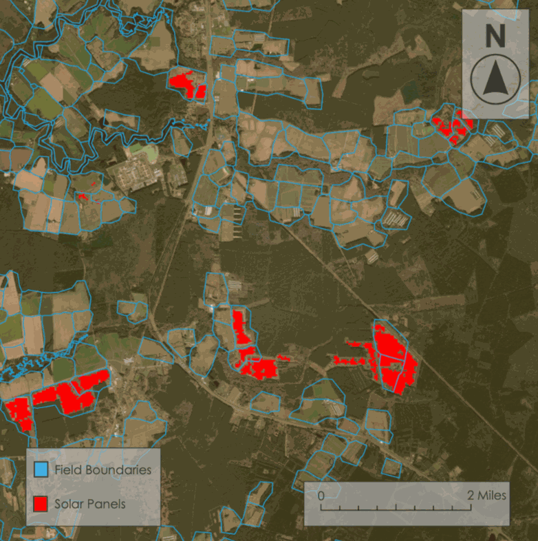
Solar project extent over soil type and crop type
NASA has also launched the EarthRISE Developers Academy, a new immersive capacity-building opportunity that builds on NASA’s long legacy of workforce development in Earth science. The Academy engages interdisciplinary teams of students, recent graduates, and early career professionals in 10-week applied projects using NASA Earth observations to address real-world challenges, while strengthening technical, communication, and collaboration skills that prepare participants for careers in the growing geospatial workforce. Learn more and apply here!