The Science Behind NASA Acres
What Can and Can’t Satellites See About Agriculture?
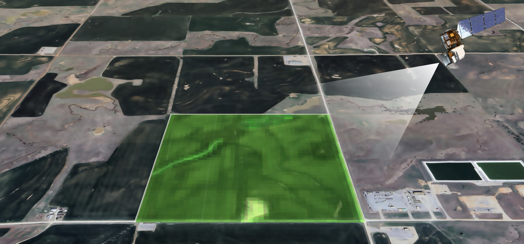
Remote sensing is a science of collecting information from afar. Remote sensing is heavily dependent upon technology in order to collect information. A very common type of technology used in remote sensing are sensors. Sensors are like specialized cameras that capture images and data by measuring how light is reflected, absorbed, and transmissioned of different wavelengths of light. Sensors are commonly installed on space satellites, aircraft, or drones. The data collected by sensors help us understand the physical properties like crop health, soil conditions, and other important information without the need to physically travel to individual field plots.
Over the last decade, the potential of satellite-based Earth observation (EO) data for farmers is growing with the rich information it can reveal - frequently, and over large areas - about the conditions of vegetation, water, and soil that the naked eye cannot see. However, the direct value that it brings to farmers within their own operations is mediated by the degree to which farmers share their on-farm data with EO innovators and analysts. At the same time, collecting and sharing farmer data for research projects raises concerns about privacy and security for farmers, as they may worry about how their personal and operational information will be used and protected, and whether it might be vulnerable to breaches or misuse.
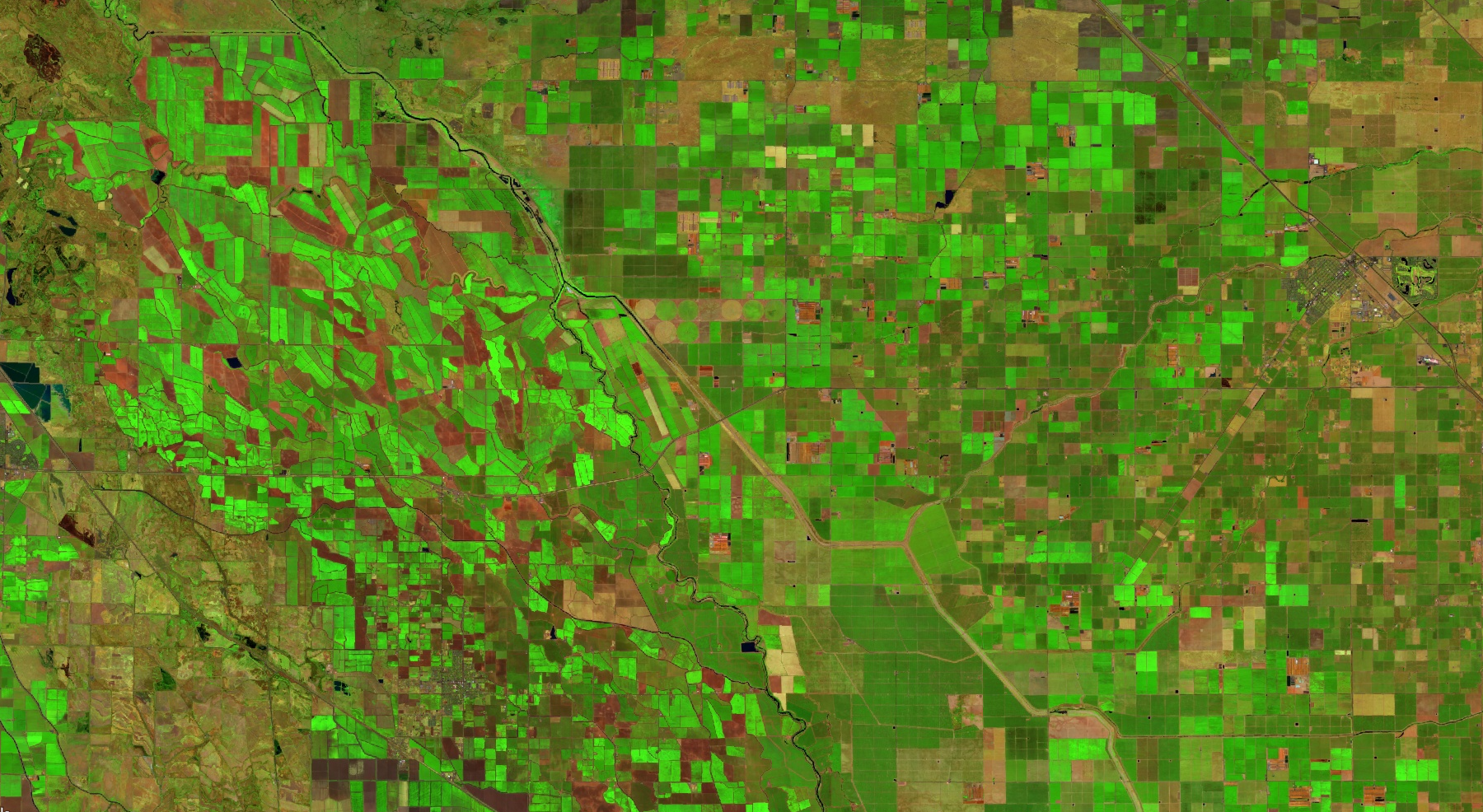
Most satellite imagery used for agriculture has a “spatial resolution” of about 10 sq feet to 0.25 acres per pixel, with that which is freely available to all (such as that from NASA) being 100 sq feet (0.025 acres) all the way to 15 acres. This means that the smallest “unit” that a freely available satellite can see is a piece of land that is 30 ft x 30 ft. For perspective, a typical car is about 15 feet x 6 ft, so we could not see a car with the vast majority of data we use. Still, at these resolutions, we can see:
patterns and boundaries of most fields in the U.S.,
large-scale crop damage or stress,
general growth stages of crops,
broad irrigation patterns,
major soil variations.
But we cannot see:
individual faces,
Personal items, license plate numbers, or equipment models,
individual animals, plants, or leaves on trees.
How do satellites mix with ground data?
Satellites provide continuous observations of the Earth that capture large-scale patterns and changes over time. However, satellite measurements come with limitations, either with the sensor itself (not all satellite sensors are ‘science’ quality), cloud coverage that can obstruct view of the land, or the images that are too coarse/grainy for a specific purpose.
This is where ground data is crucial. Measurements taken from fields provide highly accurate, direct observations of the “true” things that are happening at a specific point in time. This ground data is used to calibrate and validate the methods we develop with satellite data, so that satellites can fill the gaps in space and time where ground data are missing or too difficult or costly to collect. Ground data is crucial because it makes models more accurate and useful. More ground data, not just from one farm but from many different locations, helps models "see and verify" what’s actually happening on the ground. In other words, ground data allows us to understand how accurate and how useful our methods are, so that farmers using our tools or maps can understand how “sure” we are that they are true.
Ground data and satellite data can be integrated more quickly and faster than ever before due to advances in computing technology, which means that models relevant to sub-farm decisions are more possible than ever before. This means we can build better models that make it easier to predict things like droughts, yield trends, or pest outbreaks. This means better irrigation planning, more precise and efficient fertilizer use, earlier detection of problems like disease or nutrient deficiencies, better understanding of the impacts of different management decisions to things like yield, and better animal outcomes due to better rangeland quality information, to name a few applications. Put simply, the combination of ground data and satellite data makes remote sensing a useful on-the-ground tool, increasing profitability, efficiency, and long-term sustainability.
List and Examples of Characteristics of Agriculture NASA Acres Analyzes
Examples of Essential Agricultural Variables (EAVs) are below. EAVs are datasets that provide information about agricultural systems and can be observed using satellite data (almost always combined with farm or statistical data). This is not an exhaustive list.
Which Essential Agricultural Caroables is NASA Acres working on? Visit our project page
Vegetation Productivity:
Crop Yield and Crop Production Forecasts
Crop Condition
Rangeland/Pasture Condition
Residue Cover (Percentage)
Fractional Ground Cover
Cover Crop Performance
Crop Quality (e.g. protein, oil, starch)
Land Characteristics and Management:
Cropland and Crop Type
Crop Area Estimate
Field Boundaries and Sizes
Seasonal Fallow
Usual Crop Calendars
Land Management Calendar
Current Crop Stage
Cover Crop Utilization
Agriculture Burning
Tillage Detection
Tillage Intensity
Surface Roughness
Crop and Soil Nutrient Status
Pest and Disease Risk
Field Boundaries and Sizes
Rangeland/Pasture
Managed Grassland
Weather, Water, and Water Use:
Reference and Actual Evapotranspiration
Surface Water Availability
Water Productivity
Irrigated Cropland Map
Surface and Root Zone Soil Moisture
Shallow Water Table
Runoff
Growing Degree Days
Land Surface and Air Temperature
Wind Speed
Precipitation
Relative humidity