
Continued Development Towards Robust Monitoring of Cropland Carbon Budget Under Management Interventions in the US Heartland: Integrating Satellite Observations, Bottom-Up and Top-Down Modeling
Cross-scale sensing to integrate ground measurements, airborne hyperspectral sensing, and NASA satellite Earth observation to monitor crop nitrogen in three I states.
Project Summary
Agricultural sectors contribute 10% of the total US greenhouse gas (GHG) emissions, and 50% of that comes from farming practices. Accurately quantifying and monitoring agricultural carbon budgets is the foundation to develop effective mitigation and adaptation strategies for climate change. As climate-smart agricultural farming practices draw major attention from both public and private sectors, stakeholders are urgently demanding accurate and quantitative information for both farming practices and their impacts on cropland carbon budgets.
This proposed project is a follow-on to the 2016 NASA Carbon Monitoring System (CMS) project titled 'Improving the monitoring capability of carbon budget for the US Corn Belt - integrating multi-source satellite data with improved land surface modeling and atmospheric inversions'. Our 2016 CMS project improved satellite-based GPP product at 250 m, daily resolutions for the conterminous US from 2000 to present, and developed first version of a Model-Data Fusion (MDF) system to generate cropland carbon fluxes at the sub-county scale for the core part of the US Midwest. We also developed a North American inverse modeling system capable of using satellite and insitu atmospheric CO2 data. We successfully worked with stakeholder groups, especially the Illinois Farm Bureau, to disseminate our research to farmers.
This follow-on project will (1) expand the geographic domain to the US Heartland, (2) add crop types (corn, soybean, spring/winter wheat, cotton, sorghum, rice), and (3) improve methodology (inclusion of Artificial Intelligence-based MDF and better integration of bottom-up and top-down constraints for cropland carbon budget quantification). The primary goal of these improvements will be to move towards robust monitoring of cropland carbon budget under management interventions for the US agricultural sector. We will explicitly incorporate critical farming management practices (i.e., tillage, cover cropping, derived from satellite data) to quantify their impacts on the spatio-temporal variability of cropland carbon budget. We will also expand stakeholder advisory groups to the national scale by including American Farm Bureau Federation and US Farmer and Rancher Alliance. The following three tasks are proposed: I Task 1: Generate crop-related variables and farming management practice from different satellite sensors to cover new geography and new crops. I Task 2: Bottom-up estimation: use AI-empowered Model-Data Fusion to quantify holistic carbon budget. I Task 3: Top-down constraining: use high resolution regional atmospheric inversions and its flux reconciliation with bottom-up estimation to refine crop NEE fine-resolution product.
This current proposal targets the 2nd Research Topic in the NASA CMS solicitation: 'Studies that build upon, extend, evaluate and/or improve the existing CMS products for biomass and flux resulting from NASA's earlier phases of CMS pilot studies.' The proposed work directly addresses NASA's strategic Earth Science goals by advancing scientific understanding of planet Earth using space-based tools in a way that will directly meet societal needs. The proposed work will fully utilize various NASA satellite products (e.g., Landsat, HLS, MODIS, and Landsat-based Crop Data Layer, OCO-2), to develop improved carbon budget estimates from bottom-up approaches (process-model based), top-down approaches (jointly using satellite and in situ data in the atmospheric inversion) and their reconciliations (via 'Bridge model'). Furthermore, the proposed work establishes a framework for the continued, sustained use of NASA satellite products for future carbon budget monitoring to meet societal needs, through leveraging existing CMS non-crop products. Stakeholders, esp. farmers can use this product to inform agricultural productivity and management, further realizing the value of NASA data.
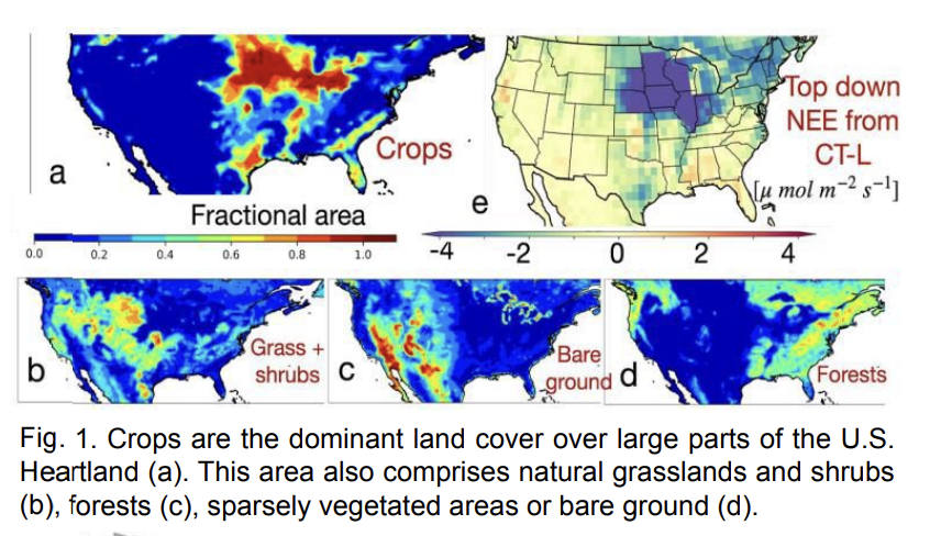
Study Area:
The Midwest at a sub-county scale
Related News:


Earth Observations Used
Landsat, HLS, MODIS, and Landsat-based Crop Data Layer, OCO-2
Lead Institution

Project Lead

Kaiyu Guan
University of Illinois Urbana- Champaign
Project Team:

Bin Peng
University of Illinois Urbana- Champaign
University of Minnesota
University of Minnesota
University of Colorado Boulder
NOAA Global Monitoring Laboratory