
AGU 2023 Recap: NASA Acres Convenes Sessions on Applications of Earth Observations for Agriculture in the U.S.
January 3, 2024 - Written By Nicole Pepper

Presenters from the NASA Acres session on ‘Applications of Earth Observations for United States Agriculture’ at the AGU 2023 Fall Meeting in San Francisco. Not all presenters are shown.
The Fall Meeting by American Geophysical Union (AGU) is the premier global event dedicated to the advancement of Earth and space sciences. In December of 2023, the event convened over 25,000 attendees from more than 100 countries in San Francisco, California. This year, the conference was centered around the theme “Wide. Open. Science.”, exploring topics on expanding collaboration across disciplines and geographic barriers and discussing ways to make Earth and space data more accessible, transparent, and, ultimately, more impactful. Scientists from NASA Acres and our sister Consortium, NASA Harvest, gathered from across the United States and overseas to attend the event and host a number of oral and poster presentations focused on applications of Earth observations (EO) for agriculture.
About the NASA Acres Sessions
The U.S. is one of the world’s top agriculture producers and exporters, supporting food security domestically and worldwide. This vital industry must confront the challenges of environmental change, extreme events, global conflict, shrinking margins for farmers, and supply chain disruptions, all while continuing to feed a growing population and protect ecosystem health. Recent advances in Earth observation (EO) data resolution, quality, accessibility, and processing have unlocked new potential to meet these challenges through the provision of low-latency, low-cost, actionable agriculture information to decision makers from across the agriculture value chain and into policy chambers. In 2023, NASA commissioned a new transdisciplinary and multisectoral consortium, NASA Acres, to unlock this potential specifically for U.S. agriculture. NASA Acres convened open oral and poster sessions title “Applications of Earth Observations for United States Agriculture” to highlight advances, opportunities, and challenges in using EO data for all types of agriculture in the U.S.
Highlights from our sessions:
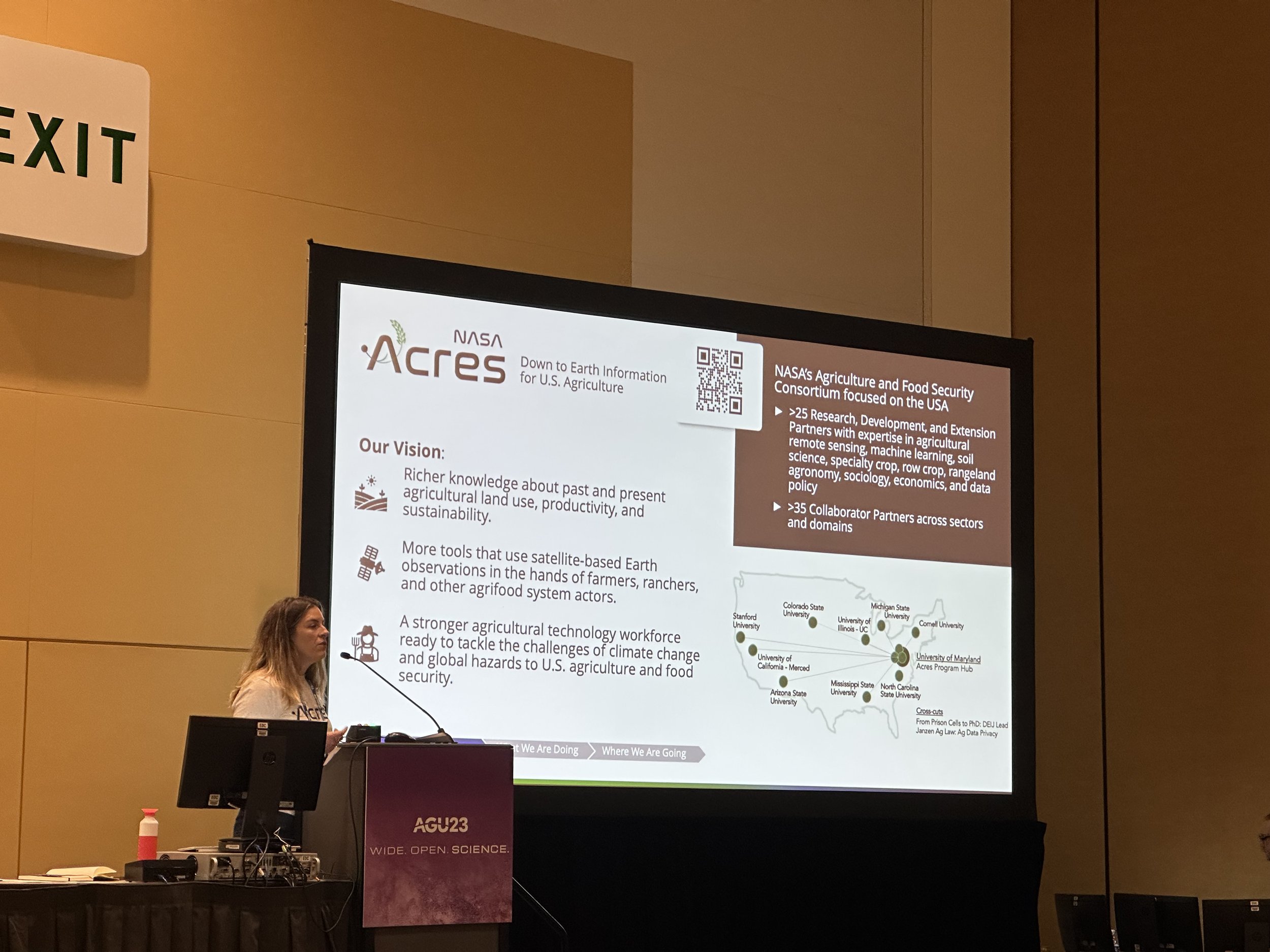
NASA Acres
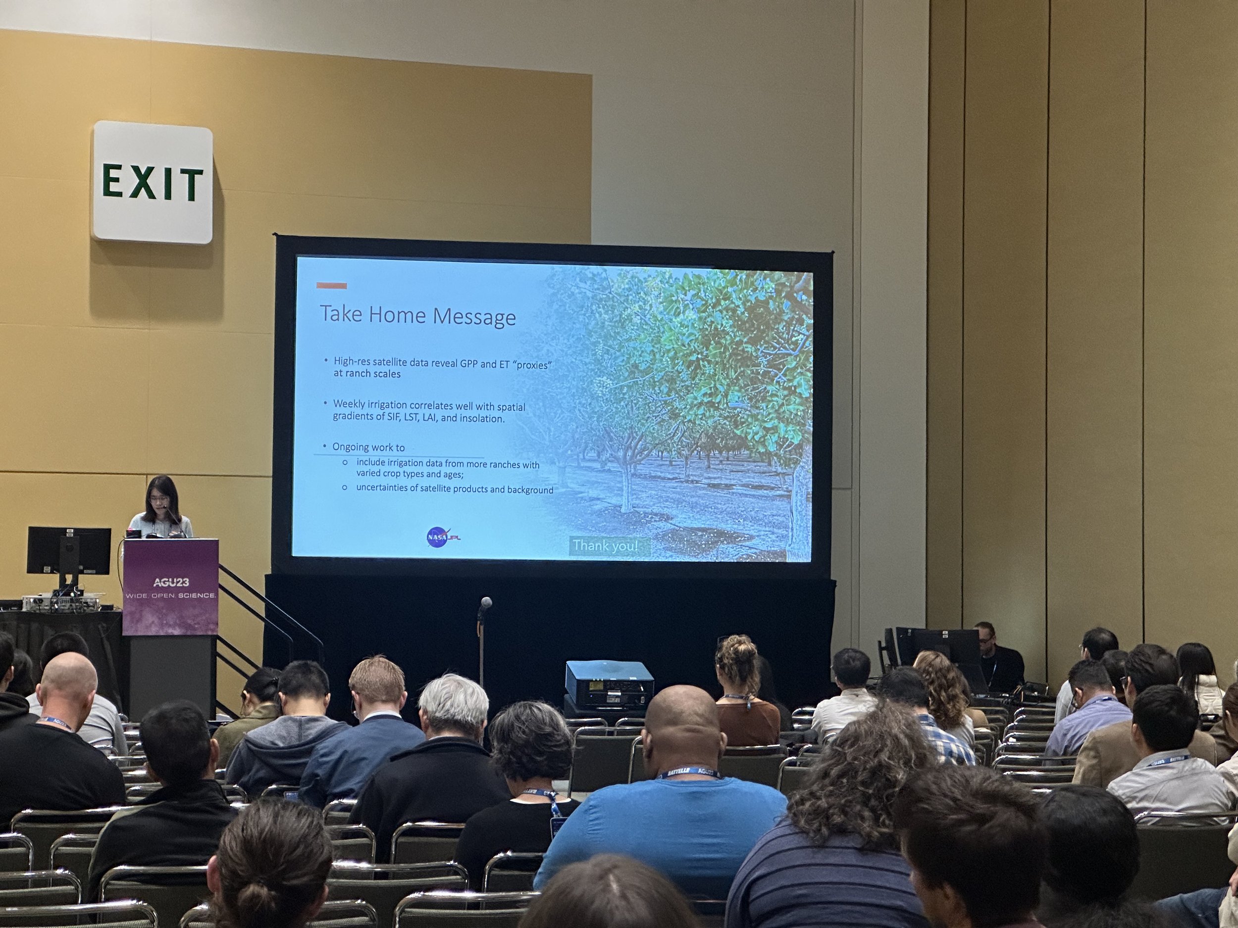
Alyssa Whitcraft, of University of Maryland and Executive Director of NASA Acres, began the session with an overview of the NASA Acres Consortium. NASA Acres advances EO-informed methods for mapping Essential Agriculture Variables (EAVs), applies the EAVs to better understand U.S. agriculture, and supports the development and transition of satellite data, products, and tools for long-term adoption. Initial projects include analyses of climate smart agriculture practices and outcomes, evaluation and forecasting of water resource available and uses, and multiple precision management-relevant work on nitrogen needs, pest and disease detection, and rangeland forage quality.
Crop Type and Yield Mapping
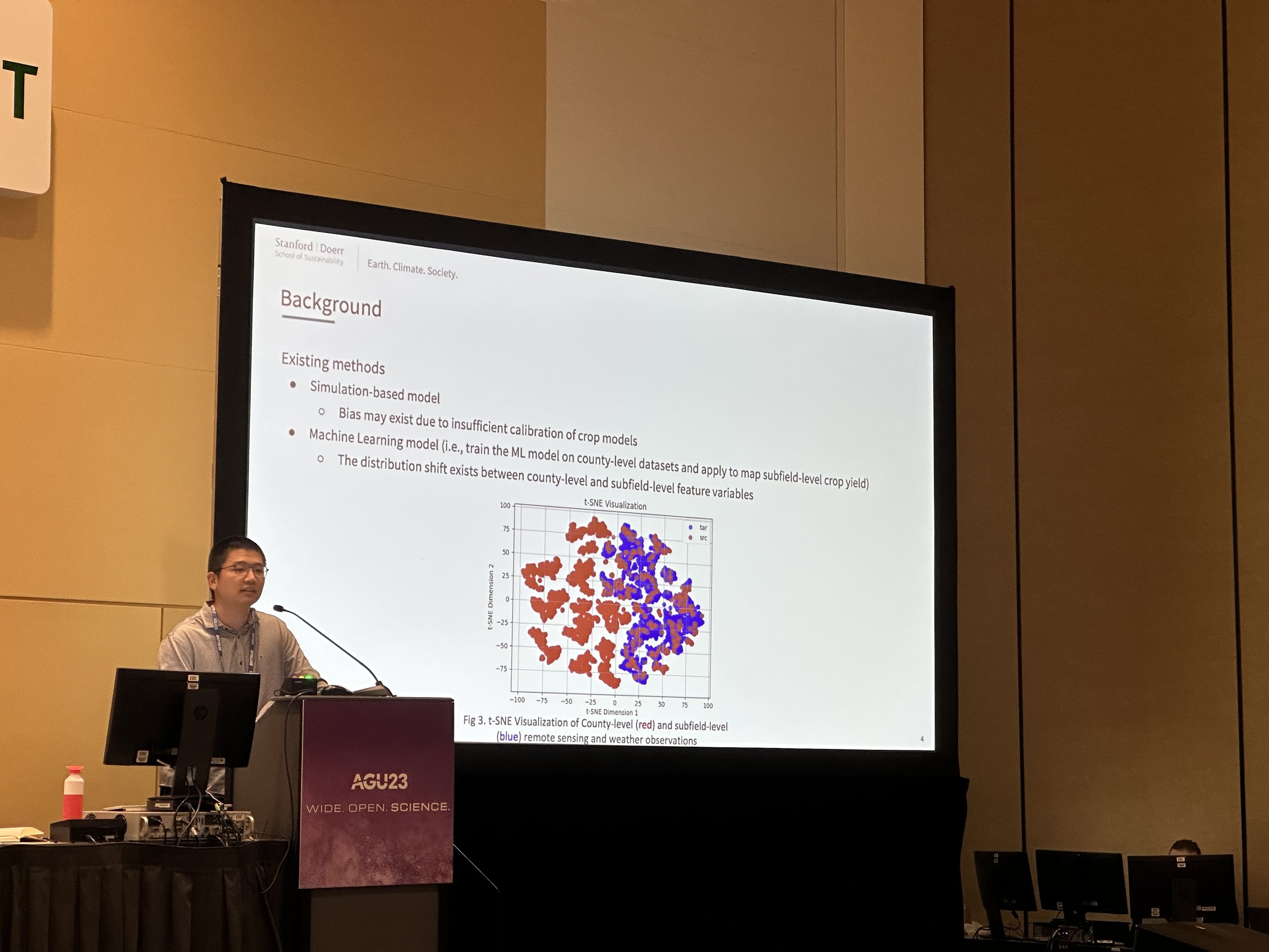
Yuchi Ma, of Stanford University, led a discussion about his group’s proposed method to improve subfield-level crop yield mapping. The method VAE-QDANN, uses a Variational AutoEncoder and quantile regression framework to filter outlier samples, reduce bias, and improve accuracy in yield estimations. Results in the U.S. corn belt from 2008-2018 have demonstrated effectiveness of the proposed framework over existing approaches on subfield estimations.
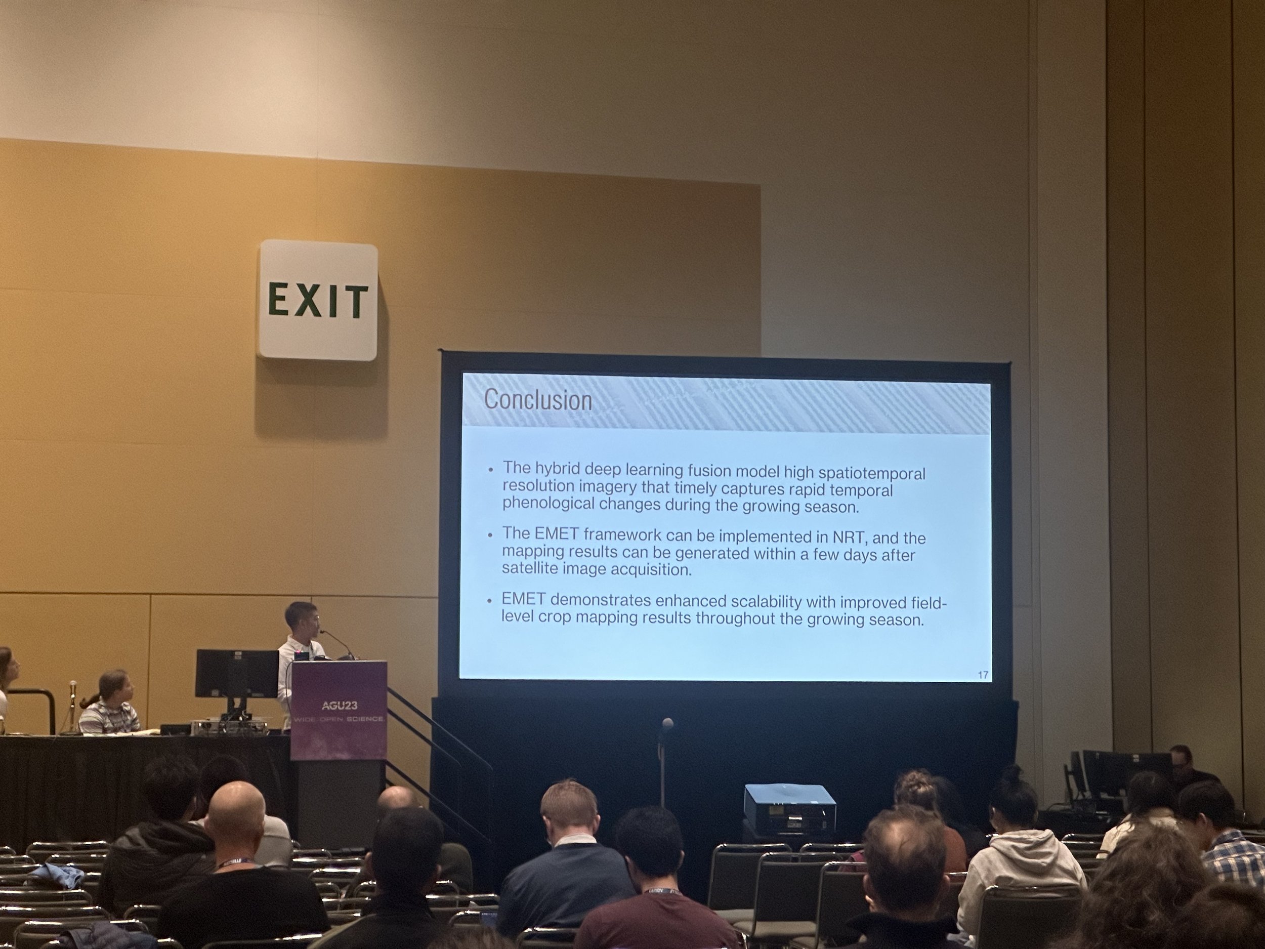
ZiJun Yang, of University of Illinois at Urbana-Champaign, reviewed his group’s emergence-based thermal phenological framework (EMET) for field-level, near real-time (NRT) crop type mapping. The EMET framework comprises of three key components:
Hybrid deep learning spatiotemporal image fusion
NRT thermal-based crop phenology normalization
NRT crop type characterization
Improved accuracy of NRT crop type mapping holds the potential to help optimize crop management and lead to more resource-efficient agriculture production.
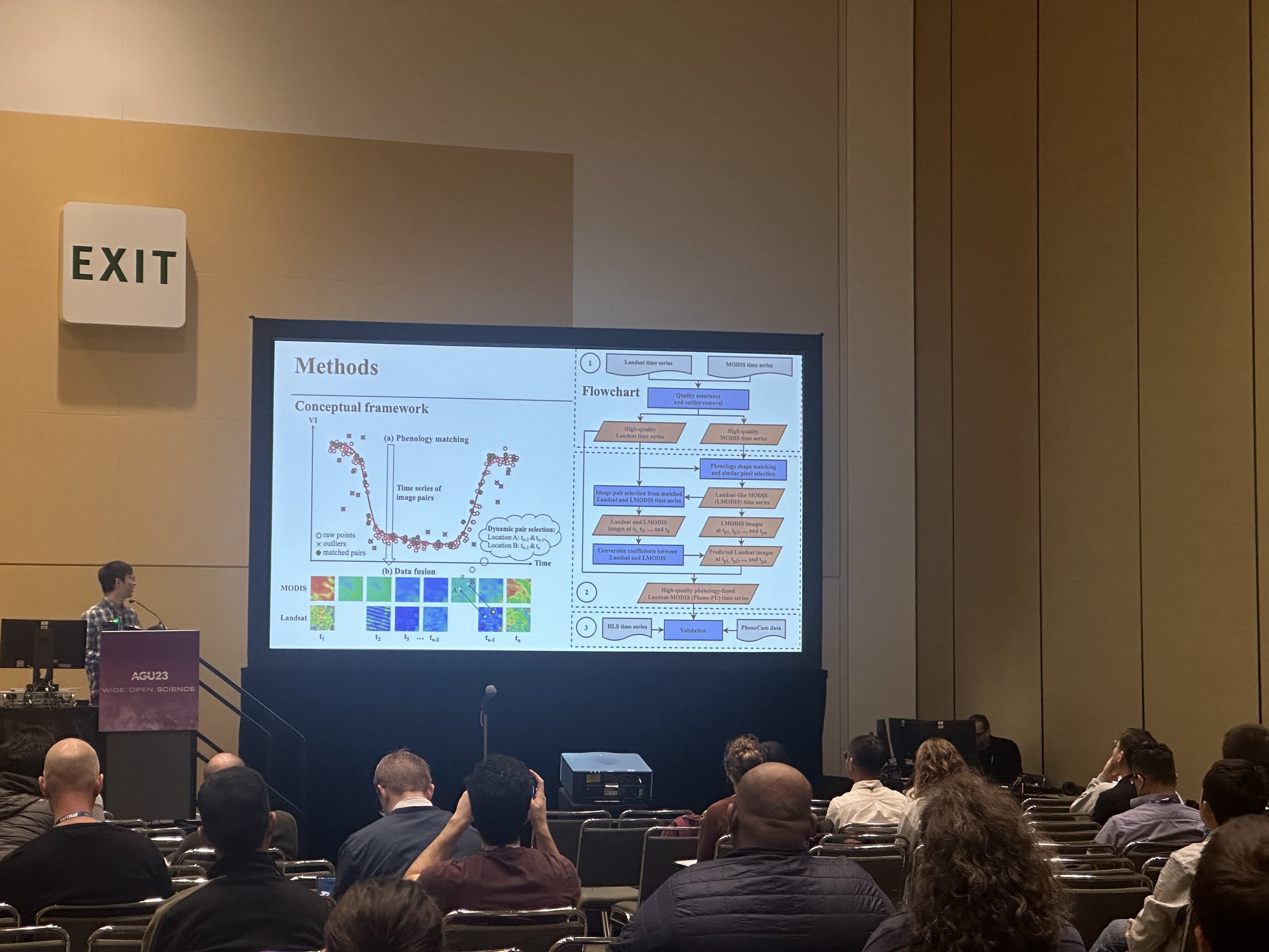
Qu Zhou, of University of Illinois at Urbana-Champaign, shared his group’s proposed phenology-guided fusion (Pheno-FU) method for compiling high-spatiotemporal-resolution Normalized Difference in Vegetation Index (NDVI) time series of summer and winter crops for field-level crop phenological modeling. The Pheno-Fu method fuses NDVI measurements from MODIS (daily, 250-m) and Landsat (16-day, 30-m) sensors since 2000 for summer crops, like corn soybean, and winter crops, like winter wheat. When benchmarked with Harmonized Landsat and Sentinel-2 (HLS) products, the preliminary results demonstrate that the Pheno-Fu method is effective for both summer and winter crops over the past two-plus decades.
Christian Abys, of University of Maryland, presented a study that assesses different strategies that utilize satellite imagery to distinguish winter wheat from winter barley in crop type maps. Their research harmonizes high-resolution (1-3m) imagery with Sentinel-1 data to develop large-scale maps of winter crops that better discern between wintery barley and wheat, providing valuable information on food security monitoring at both the national and global scales.
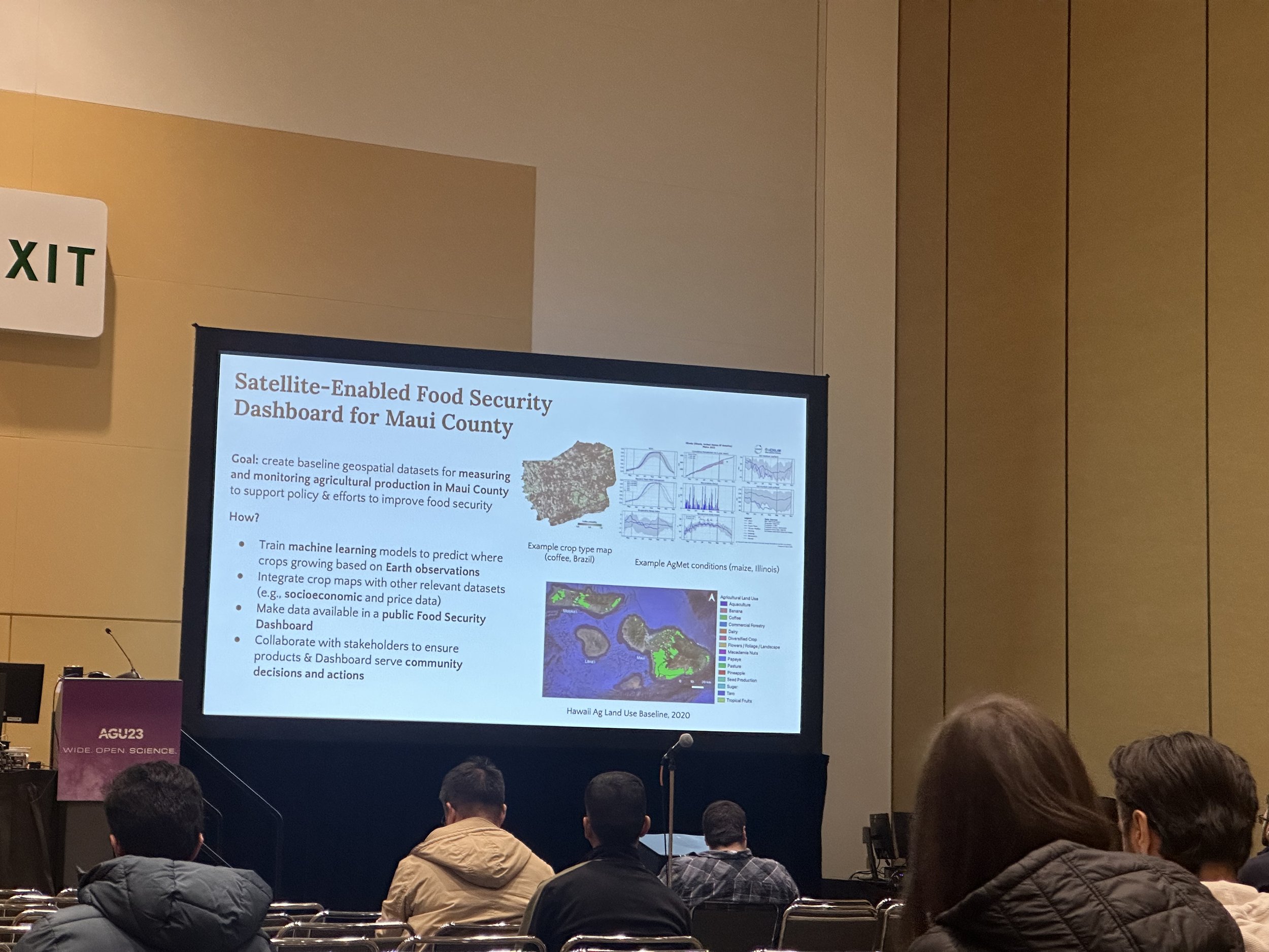
Hannah Kerner, of Arizona State University, presented her work with NASA Acres, Maui United Way, University of Maui College, and Responsible Markets to develop data products using satellite Earth observations and machine learning to visualize crop conditions, food availability, and other valuable agriculture information across Maui County. In her presentation, she shared early results from the first year of the project including crop type mapping and a student-focused field data collection pilot program, ‘Āina Data Stewards.
Tillage & Cover Crops
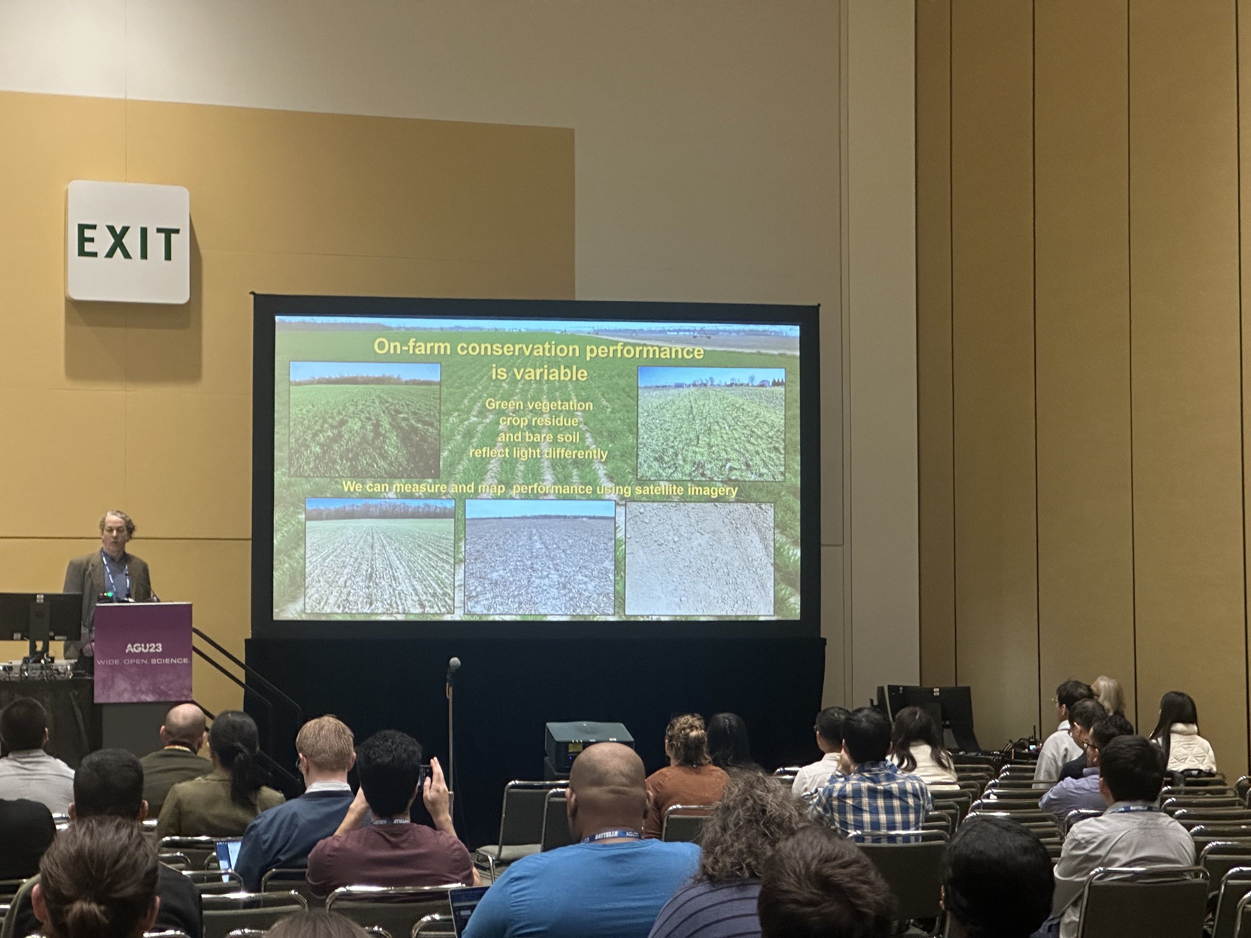
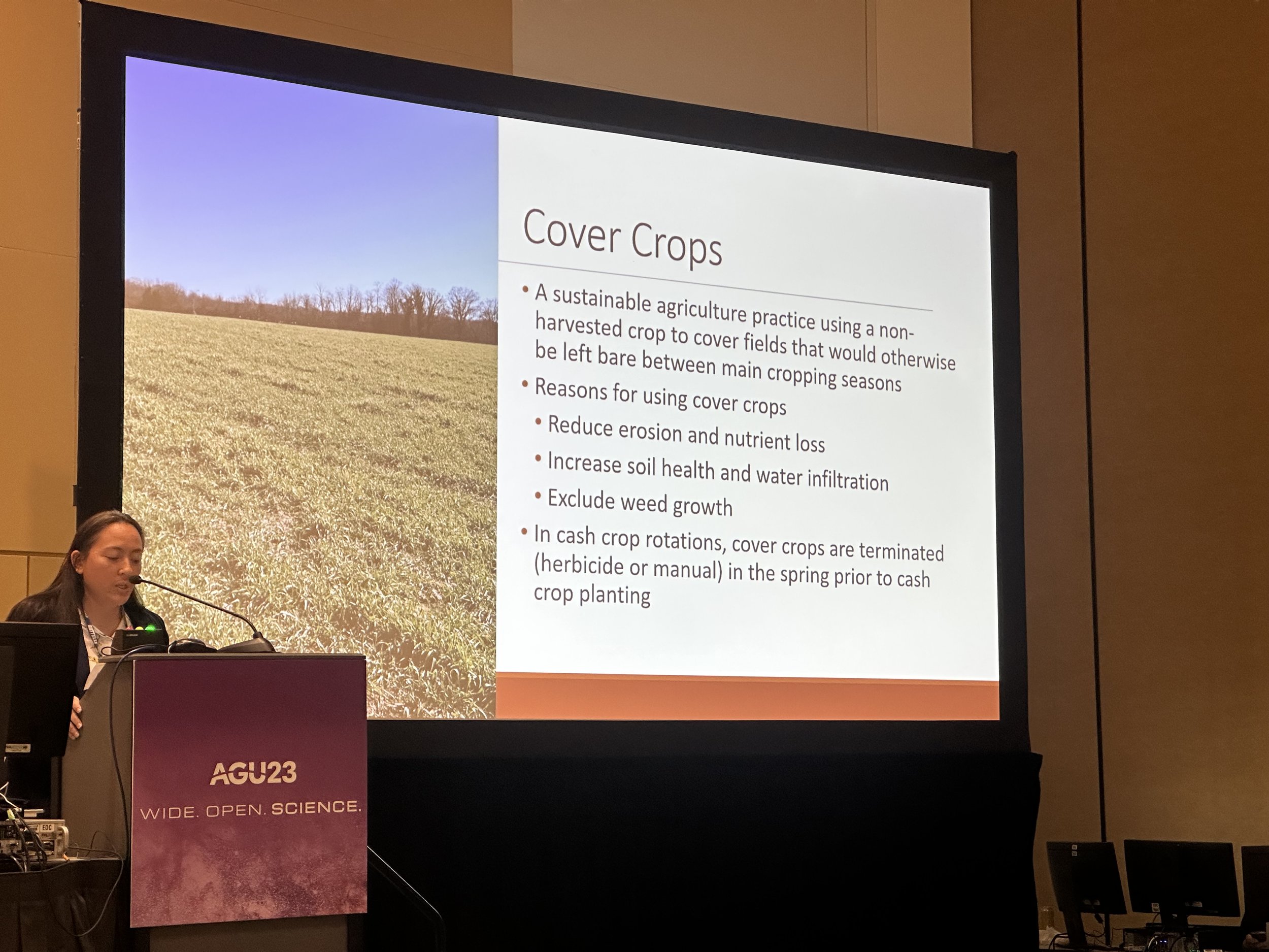
W. D. Hively, of the U.S. Geological Survey, discussed his group’s method using Harmonized Landsat and Sentinel (HLS) satellite imagery to differentiate winter cover crops from winter grains grown for harvest, by determining crop termination dates. This information can be useful in helping better understand cover crop performance as well as in managing programs for cover crop incentivization.
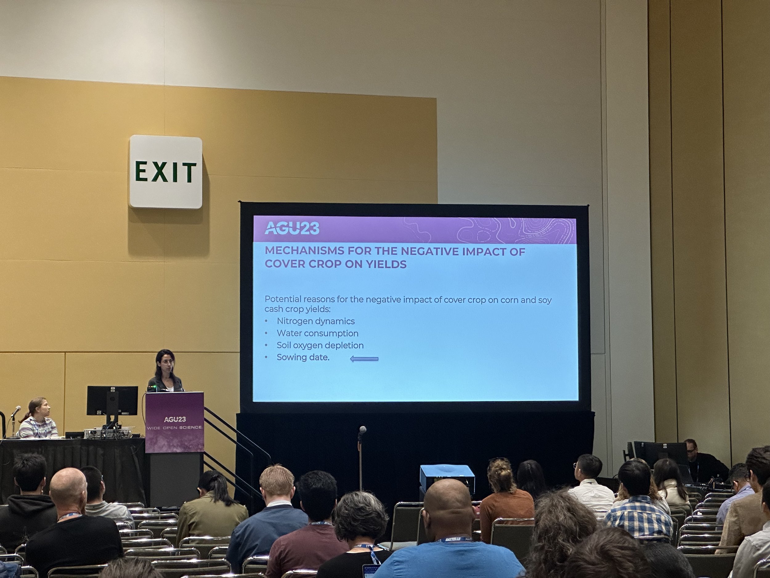
Stefania Di Tommaso, of Stanford University, shared her group’s method that will use satellite records of cover crops, yields, and planting dates to understand the impacts of cover crop adoption on maize and soybean yields. This research will help improve our understanding of the magnitude of yield loss associated with cover crop adoption and identify the mechanisms contributing to such losses, for improved guidance on the implementation of cover crops as a climate-smart agriculture practice.
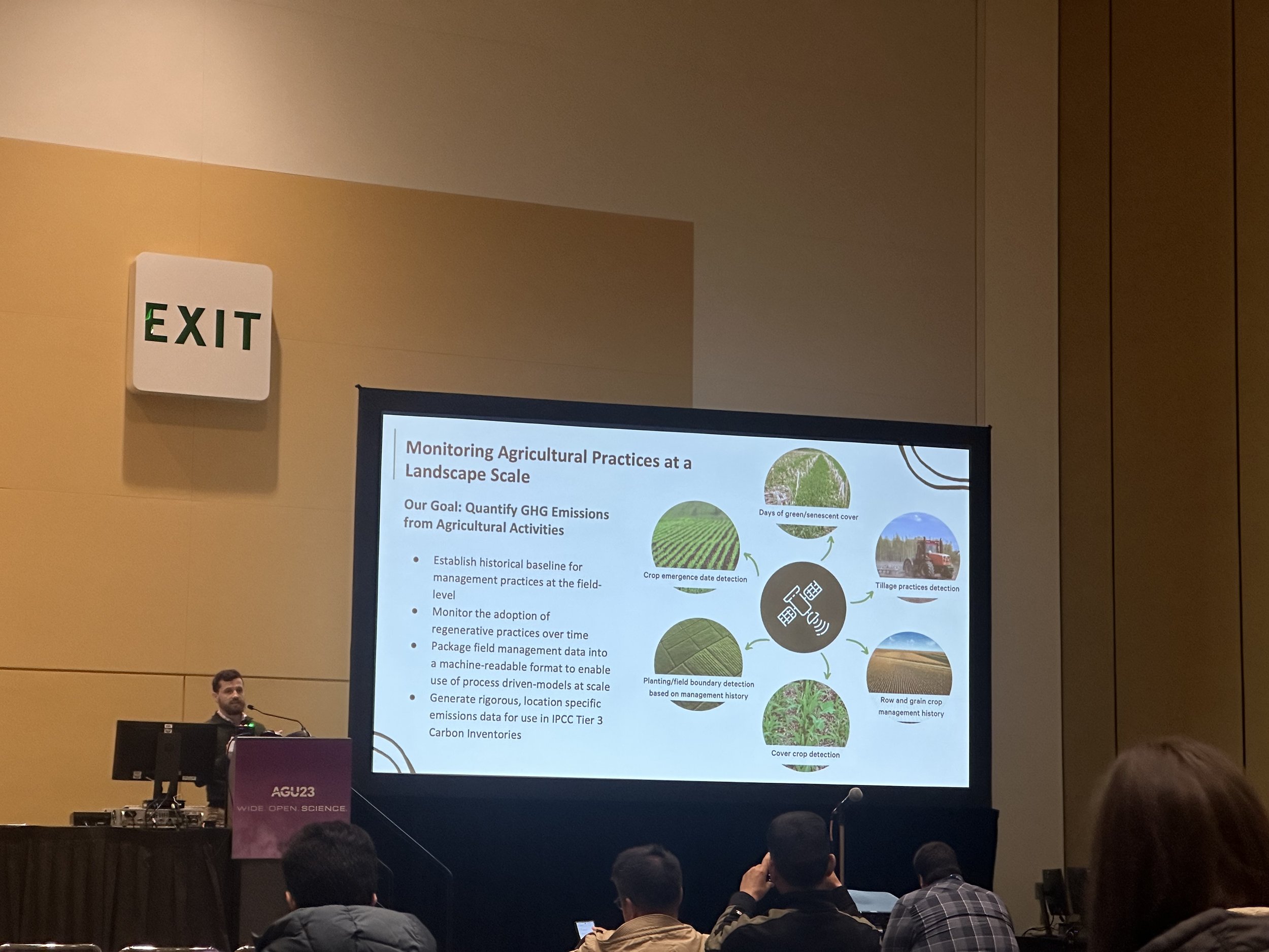
John Shriver, of Regrow Ag, presented on their framework for estimating field-level regenerative agriculture practices. Their framework leverages models that incorporate satellite data to detect and capture the effect of conservation practices. Results have demonstrated similar levels of tillage and cover crop adoption to national statistics. On a regional scale, these monitoring systems can help streamline enrollment and incentivize and verify conservation practice implementation.
Agriculture & the Atmosphere
Dien Wu, of the California Institute of Technology, presented her group’s new approach to modeling water use efficiency (WUE) over agricultural regions in California. Their methods fuse space-based retrievals at the kilometer scale from the Orbiting Carbon Observatory (OCO-2/30, TROPOspheric Monitoring Instrument (TOPOMI), and ECOsystem Spaceborne Thermal Radiometer Experiment on Space Station (ECOSTRESS) to assess agriculture signatures related to carbon uptake and moisture sources.
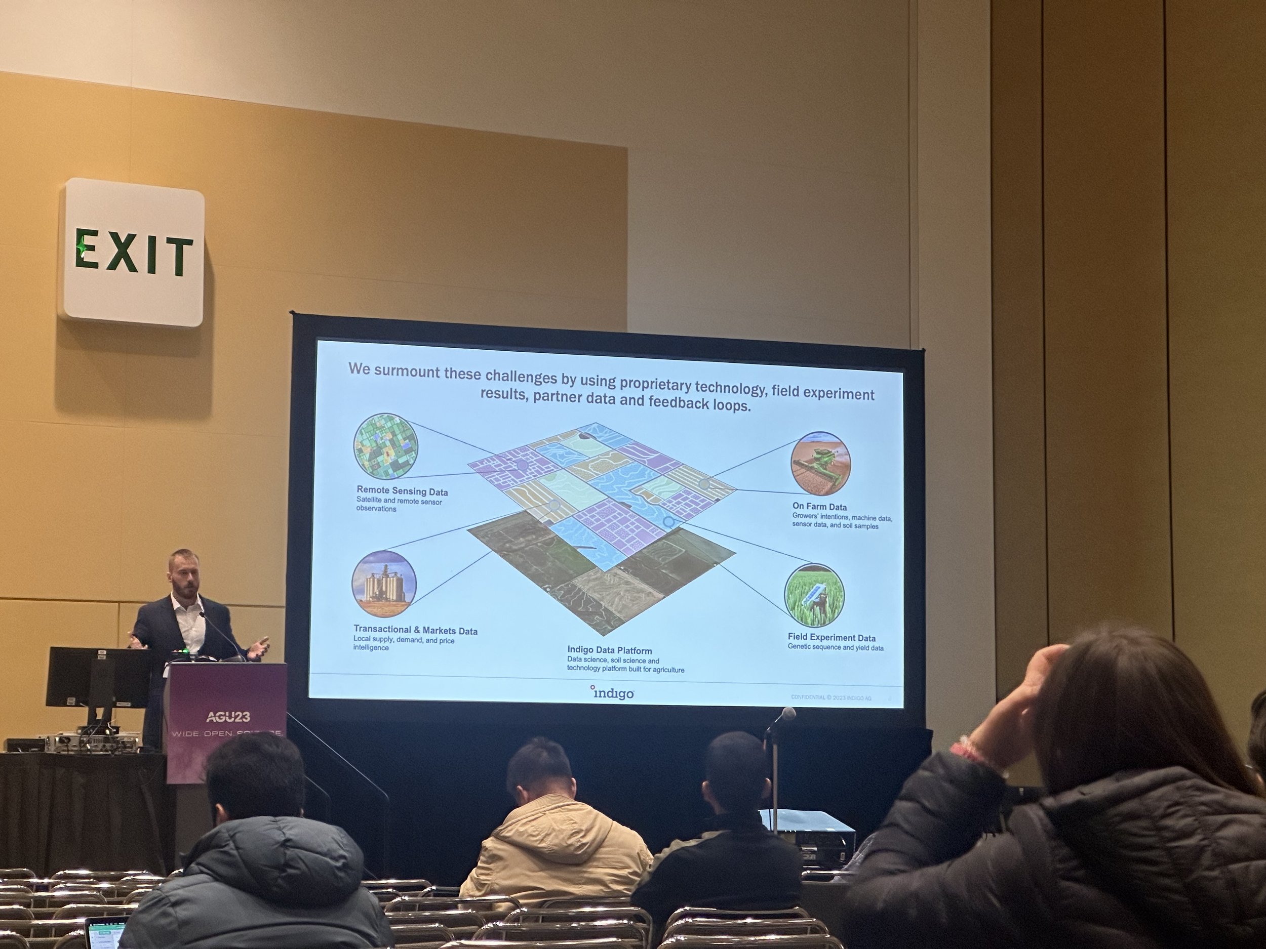
Jay Weeks, of Indigo Ag. Inc, presented on improved methods to estimate annual greenhouse gas (GHG) emissions at the continental-scale for corn, wheat, and other commodity field crops. Their methods use machine learning on large, publicly available datasets including Harmonized Landsat-Sentinel (HLS) imagery and USDA survey responses as well as private, field-level management data from growers to estimate GHG emissions. This approach demonstrates a potential to use their framework for rapid and affordable, regional-scale assessments without ground data requirements.
Ranching
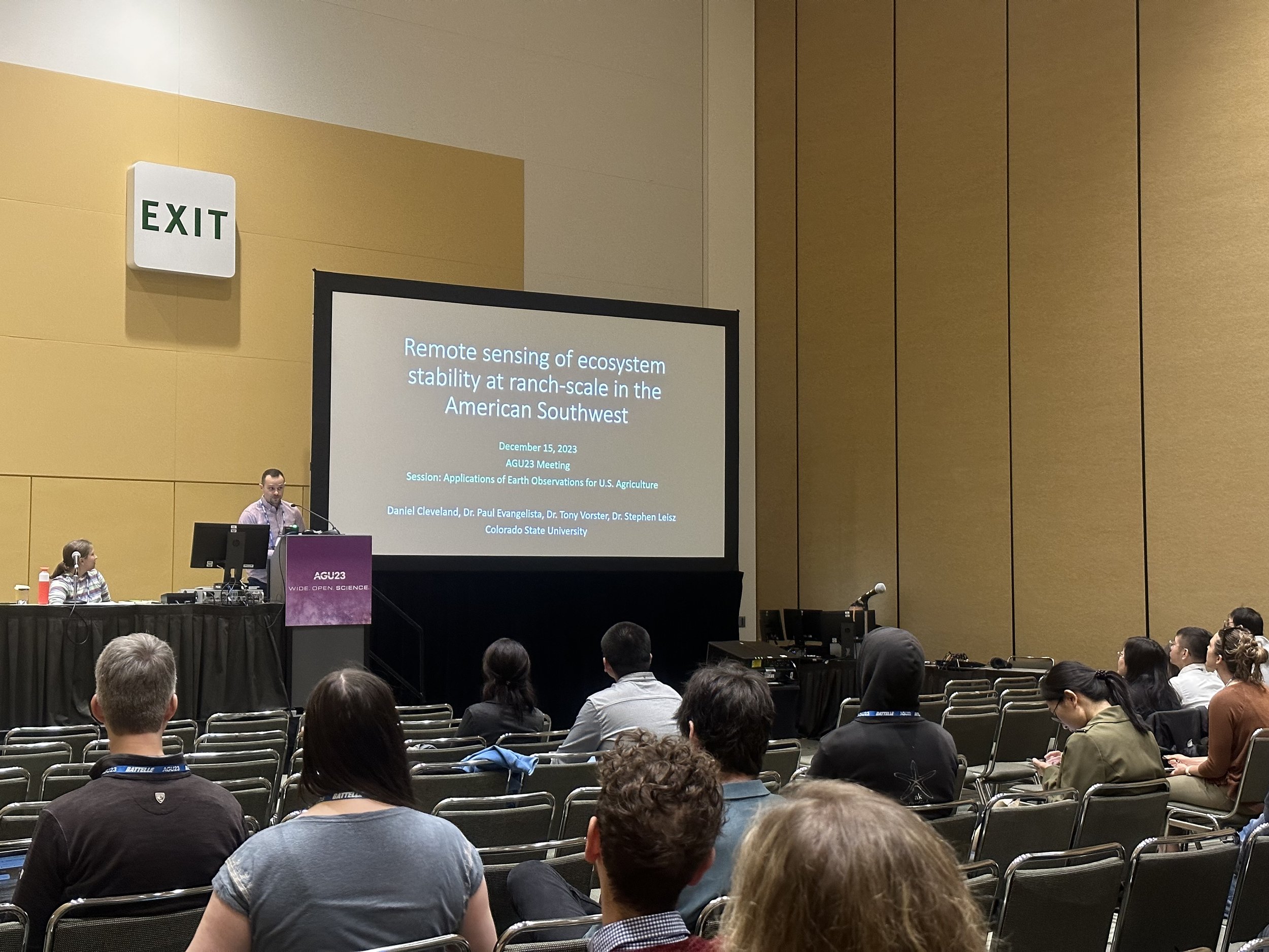
Daniel Cleveland, of Colorado State University Fort Collins, discussed his group's research that will utilize satellite remote sensing to help ranchers across the American Southwest in monitoring the impacts of their management practices on ecosystem stability. Their research will look at changes in the Soil Adjusted Vegetation Index (SAVI) on a 6,500-acre ranch in New Mexico, relative to its surrounding region, to assess ecosystem health before and after the adoption of new ranch management practices.
Nutrient Management
Alison Thieme, of the U.S. Department of Agriculture - Agricultural Research Service (USDA - ARS), presented on how Earth Observations can support nutrient management, specifically variable rate nitrogen fertilizer applications. Her group has developed a publicly available tool, the Cover Crop Nitrogen Calculator (cc-ncalc.org) to estimate the quantity and timing of nitrogen release from decomposing cover crops using Harmonized Landsat-2 (HLS) imagery to estimate cover crop biomass. They are exploring how EO and other imaging can provide information on in-field crop variation to improve the accuracy of outputs and better inform variable rate nitrogen fertilizer applications.
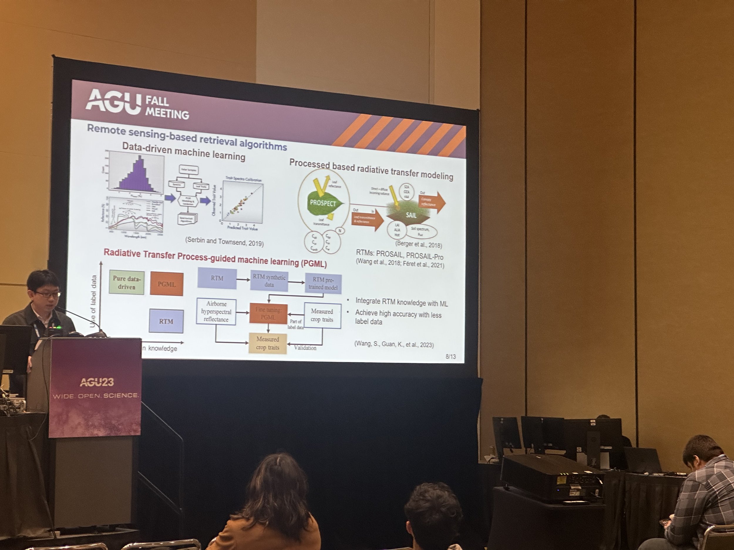
Sheng Wang, of University of Illinois at Urbana-Champaign, discussed his group’s new framework to integrate satellite Earth observations, like Harmonized Landsat and Sentinel-2 (HLS) products, with proximal, hyperspectral airborne sensors to to derive crop nitrogen for every corn field across Illinois. This cross-scaling framework has a high potential to serve as a scalable solution to quantify high-resolution crop nitrogen at the regional scale and to support efficient fertilization management.
Pest & Disease Detection
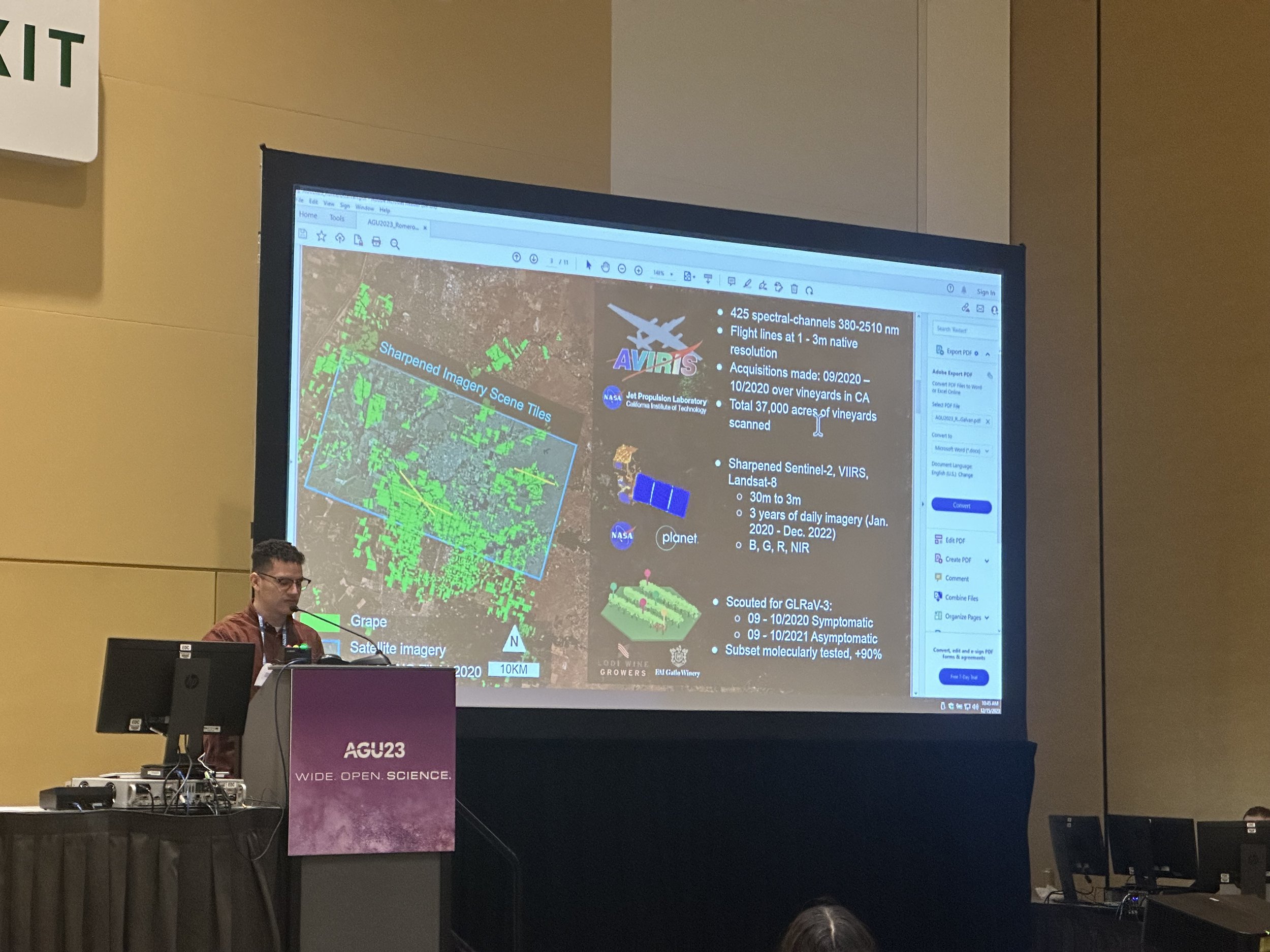
Fernando Romero, of Cornell University, presented his team’s work mapping grapevine viral disease using imagery derived from MODIS, VIIRS, and Landsat thermal imagery, in combination with Planet Labs Planetscope multispectral imagery and AVIRIS-NG spectroscopic imagery, at a vineyard in California. Their methods establish a scalable and effective framework for early plant disease detection and differentiation from abiotic stress.
Summary of Our Sessions
The collaborative efforts of the researchers and scientists featured in our sessions showcase the profound impact of wide-open science, offering actionable insights to address the challenges faced by the agriculture industry and showcasing the potential of collaborative, open science initiatives on a national scale. Beyond the NASA Acres sessions, there were many insightful presentations on agriculture throughout the week at AGU23. The momentum is there and this collective work is crucial to maintaining and building a resilient food system.
NASA Acres would like to extend our gratitude to all of the presenters who contributed to our sessions.
About NASA Acres:
NASA Acres brings the value of Earth observation technology down to Earth. We bridge the gap from space-to-farm and education-to-impact together with U.S. farmers, ranchers, and other agrifood system decision makers who are charged with addressing the most pressing challenges to resource-efficient, productive, and resilient agriculture, both today and into the next generation.
NASA Acres website: nasaacres.org
Twitter: @AcresProgram
For media inquiries or more information, please contact:
Nicole Pepper
Communications and Outreach Coordinator, NASA Acres
For More Details on our AGU23 Sessions and Presenters, please visit: https://www.nasaacres.org/events/agu-2023