Resources for Producers
Satellite data can help farmers and ranchers make more informed decisions, from monitoring crop health and managing water use to improving fertilizer efficiency and tracking changes across their land.
Explore tools and resources developed with support from NASA Acres, along with other publicly available and commercial platforms that put satellite data and agricultural information at your fingertips. Whether you're managing crops, rangelands, or other agricultural products, these resources offer new ways to understand conditions, improve efficiency, and support decisions on your operation.
NASA Acres-Supported Tools and Resources
A new resource designed to make satellite-based agricultural information more accessible and useful for farmers and ranchers.
NASA Acres App (coming soon)
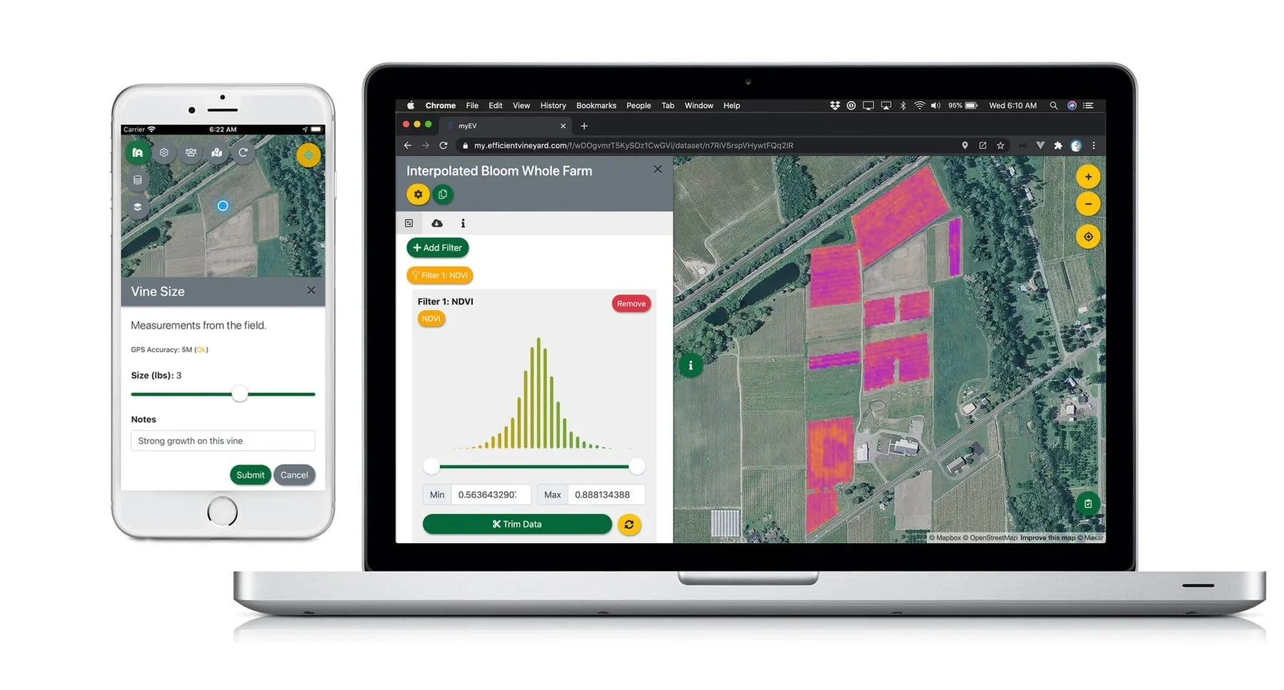
Bring satellite imagery, field observations, and farm data together in one place. Map your fields, track conditions, collect scouting information, and create management maps to support more precise decisions.
Find an economically optimal nitrogen fertilizer rate for corn production. Use information about fertilizer prices and crop production to identify rates that balance productivity and profitability.
Explore local crop conditions, rainfall, soil moisture, and other information affecting agriculture across Maui County, Hawaiʻi. The Crop Monitor provides regional updates and practical insights to support local growers.
Explore local crop conditions, rainfall, soil moisture, and other information affecting agriculture across Maui County, Hawaiʻi. The Crop Monitor provides regional updates and practical insights to support local growers.
Explore satellite-based maps of crop and vegetation conditions, track changes throughout the growing season, and compare current conditions with historical patterns.
Global Agriculture Monitoring (GLAM)

Our adaptable methodology serves manufacturing, retail, professional services, and public sector entities.
NASA Tools and Resources
See how much water crops and vegetation are using with satellite-based estimates of evapotranspiration (ET). Explore field-level water use over time to help inform irrigation planning and water management.
Follow growing conditions for major crops around the world through regularly updated maps, reports, and assessments. Gain a broader perspective on weather impacts, crop development, and global production conditions.
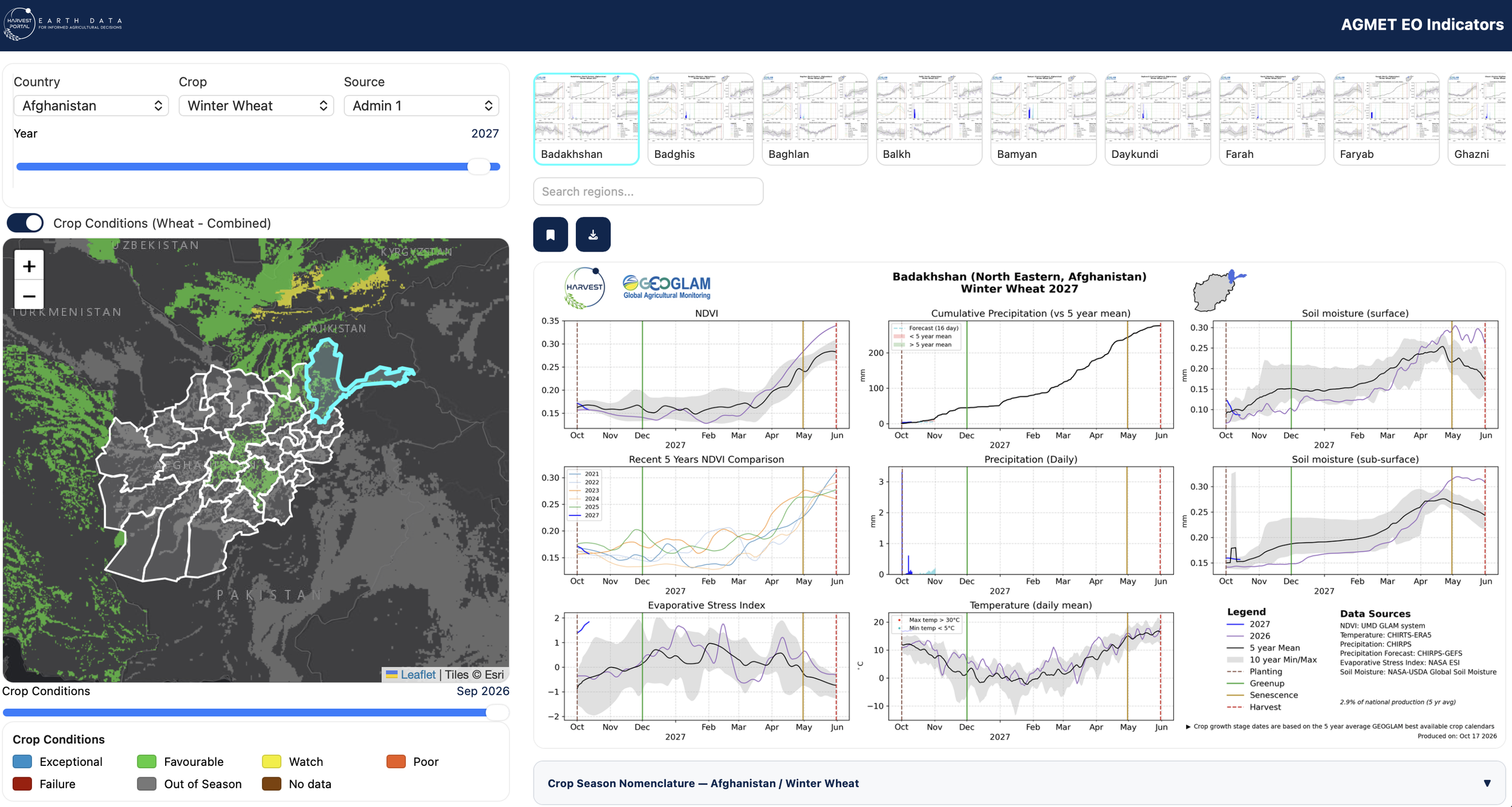
Explore weather and satellite-based indicators affecting crops around the world, including rainfall, temperature, soil moisture, and vegetation health. Compare current growing conditions with historical patterns.
Explore satellite imagery from around the world, including recent and historical observations. See changes in vegetation, drought conditions, flooding, wildfires, and other events affecting agricultural landscapes.
Search NASA's extensive collection of satellite imagery and environmental data. Find and download information about vegetation, soil moisture, land conditions, and other variables relevant to agriculture.
Explore interactive maps and visualizations of NASA Earth science data. Compare environmental conditions and changes over time using satellite-based datasets.
Explore satellite coverage and available observations for locations around the world. Find out which Earth-observing satellites have collected imagery over a particular area.


Learn how to use satellite data through free online training courses and webinars. Topics include agriculture, drought, water resources, and land management, with introductory and more advanced learning opportunities.



Other Agency & Public Resources
Monitor vegetation cover and forage production across U.S. rangelands. Compare current conditions with historical trends to help inform grazing management, assess productivity, and track landscape changes.
Search and download Landsat satellite imagery, aerial photographs, and historical land observations. Explore how fields, vegetation, and land use have changed over time.
Access satellite imagery and environmental information from the European Union's Copernicus program. Monitor vegetation, land conditions, and changes across agricultural landscapes using Sentinel satellite observations.


Commercial Tools & Platforms
Explore high-resolution satellite imagery, compare observations across dates, and visualize changes in fields and landscapes. Available imagery and analysis capabilities depend on your account and data access.
Create interactive maps that bring together satellite imagery, field boundaries, and other geographic information. Explore patterns, visualize data, and share maps with collaborators.